


MANILA, Philippines — Weakened Tropical Storm Ofel reentered the Philippine area of responsibility (PAR) on Friday night, state meteorologists said.
The Philippine Atmospheric, Geophysical and Astronomical Services Administration (Pagasa) said Ofel reentered PAR at 10:00 p.m.
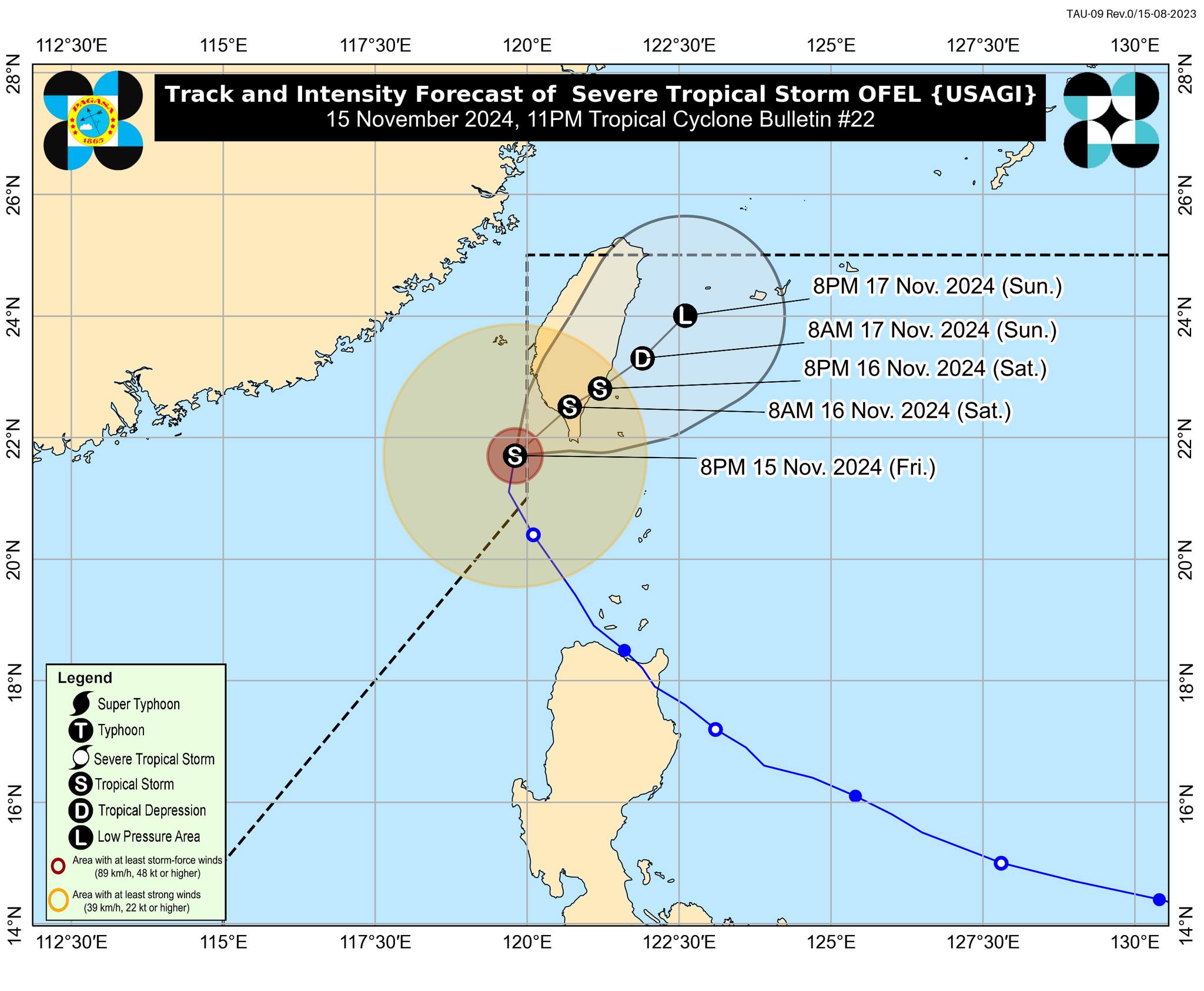
Ofel was last spotted 220 kilometers west northwest of Itbayat, Batanes, packing maximum sustained winds of 85 kilometers per hour (kph) with gustiness of 105 kph, according to Pagasa.
READ: LIVE UPDATES: Typhoon Ofel
“It is forecast to move northwestward throughout the forecast period, traversing southern Taiwan and emerging over the sea east of Taiwan from tonight until tomorrow,” Pagasa said in its 11:00 p.m. update.
Pagasa said Ofel is seen to further weaken “due to the increasingly unfavorable environment and interaction with the mountainous terrain of Taiwan.”
Furthermore, Ofel may eventually downgrade into a remnant Low on Sunday evening or even earlier.
READ: Ofel nears super typhoon category; Cagayan under Signal No. 4
At its peak, Ofel neared the Super Typhoon category on Thursday.